Designing attractive green & blue spaces in Gothenburg
New blue and green structures at Backaplan
@Mareld
North of the river Göta Älv in Gothenburg, Sweden, a new neighbourhood is now emerging: The Backaplan area, which is currently a traditional big-box out-of-town style shopping center, will, over the years to come, evolve into a vibrant mixed-use development with housing, offices, and a modern retail quarter alongside several new public spaces, streets and parks.
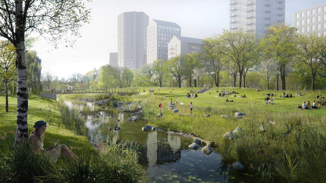
As part of this urban transformation, a new City Park will take shape along the Kvillebäcken stream, creating an attractive blue-green corridor linking the city centre with Jubileumsparken to the south and the Hökällan Nature Reserve to the north. Once complete, the park, approximately one hundred metres wide and one kilometre long, will provide much-needed green and blue space, benefiting residents and visitors alike while strengthening habitats for local flora and fauna. Particular focus has been placed on the design and integration of ecological shoreline along the river where nature and natural processes have been priortised.
MARELD has led the project team and design process in collaboration with Ramboll, contributing specialist expertise in water and flood risk management.
Integrated green and blue infrastructure
The park is designed to feel generous and open, offering a welcome retreat from city life while enabling smooth movement for pedestrians and cyclists through a network of cross-links that connect to nearby destinations.
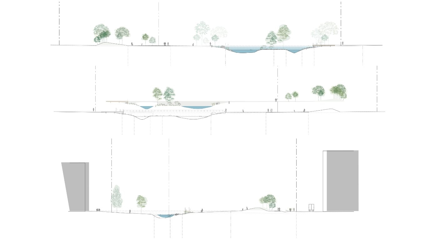
Because Kvillebäcken’s existing channel has limited capacity and has caused flooding both upstream and downstream during high flows and cloudburst events, the design also strengthens flood resilience. During cloudbursts, larger volumes of water can be managed by widening the watercourse at several strategic locations.
The reconfigured stream will meander through the park landscape, combining an appealing natural character with robust stormwater management, mineral edges will help prevent erosion and help provide new habitat together with other shoreline areas that combine stone, garvel and sands that support insects and small reptiles.
The blue structure aims to reduce the flood risk by managing the existing capacity deficiency and detaining stormwater. It has also been designed to ensure that the water meets the local water quality requirements.
When the park transitions over to the surrounding network of streets and square, stormwater will be managed through swales and rain gardens to delay flow rates and filter and cleanse water in advance of reaching the park. Where appropriate, swales may be designed with crushed stone to further enhance water treatment efficiency.
The flood risk has been determined through the study of three scenarios: Highest high water due to high sea level (Göta Älv), highest high water due to high flow in Kvillebäcken, and highest water level due to cloudburst.
Neighbourhood Park (Bostadsnära parken)
To the north of the Backaplan area the project team have also designed a Neighbourhood Park, which is approximately 13,500 m2 and provides an important open space as part of DP2 green infrastructure proposals.
The Southern part of this park connects to Backaplan’s Active Urban Greenery (AUG) which is a series of smaller blue and green corridors that provide balance and harmony amongst the high-density city development.
Image gallery
Image gallery
1 / 4
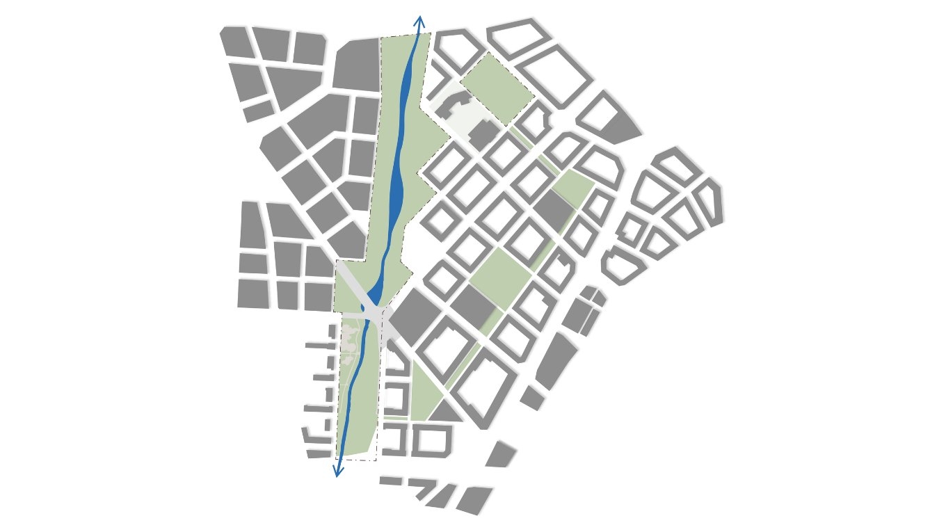
Overview sketch of the blue structure
Mareld
2 / 4
Three section sketches illustrating water capacity during cloudburst and high-water levels
Mareld
3 / 4
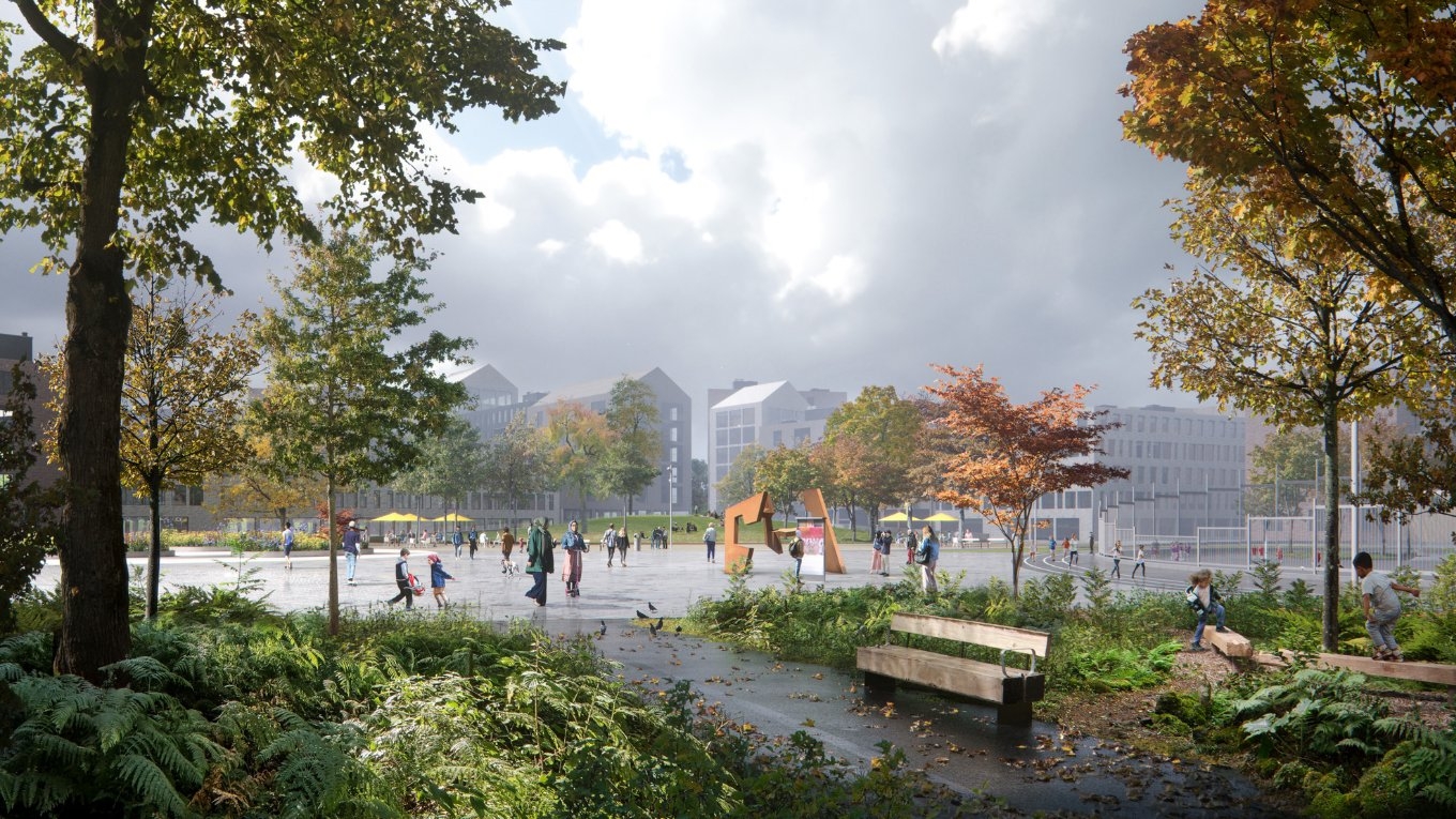
Playground in the City Park
Mareld
4 / 4
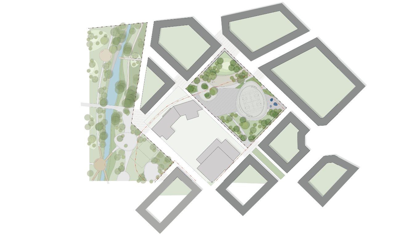
Illustrative overview of the area
Mareld
Overview sketch of the blue structure
Mareld
Three section sketches illustrating water capacity during cloudburst and high-water levels
Mareld
Playground in the City Park
Mareld
Illustrative overview of the area
Mareld
1 / 4
Overview sketch of the blue structure
Mareld